More Paddling in Greece

More Paddling in Greece

Judy Blight
(Photos by Rod Feldtmann)

This year, as I was going to travel on the last voyage of the QE2 from Southampton to New York I decided that I was not going to waste the opportunity and so of course I went sea kayaking in the islands around Greece.

I did spend 10 days in Kefalonia in the Ionian Sea once again with Pavlos and Yvonne who run Monte-Nero Activities. It was a sensational experience but you can read about it in my article I wrote last year.

This year I visited the island of Milos in the Aegean Sea. It is the most southwesterly of the Cycladic group and lies about halfway between Athens and the island of Crete. It is about 20km long, in an east west direction and about 10 to 15km north-south. Its most famous export is the Venus De Milo, a 4th century BC statue of Aphrodite. On this island lives Rod Feldtmann, an Aussie who runs the only other commercial company in Greece (Sea Kayak Milos). He went there as a geologist and ended up marrying Petrinela, who is a local girl. She runs the bed and breakfast in Triovasalos and he the kayaking side. He is a great teacher and is a 5 star British canoe Union paddler and 4 star coach with a dry Aussie humour.

This island has been shaped by millions of years of volcanic activity so it has soaring cliffs and magical caves. The superb villages with the typical blue and white architecture look spectacular perched on the clifftops. It is also great because it is not as touristy as other Greek Islands and is an island where Greeks go for their holidays and tends to not have the pushy frenetic pace of the popular islands. It is untouched by hotel chains and package tourism and the authentic local culture has been preserved. There are plenty of interesting ancient ruins to explore on the days off from paddling.

I actually stayed in the guest house run by Rod’s wife and family (at 30 Euro it was cheaper than anywhere else in Greece) and each day we would be driven to a different place to paddle. If it was too windy on one side of the island he would take us to a place out of the wind on the other side. In the evenings it was just a walk up the hill to the Plaka and the many restaurants where we enjoyed the Greek beer, Mythos.

On one of our day trips we met up with Hadas Feldman, an Israeli Instructor and world kayak adventurer who has kayaked with Justine Curgenvan and appeared in This is the Sea DVD. She was circumnavigating the island with a group from Israel. They did it in a week so it is not a really big island. This was travelling leisurely and spending time exploring and having free days to explore the 70 or so beaches. Rod hires kayaks so it is possible to go off on your own with a group.

The most spectacular place to paddle was Kleftico. The coastline on the way is interesting as you creep along exploring all the nooks and crannies. Suddenly, the sea arches come into view and you realize this is some place special. Rod always encourages paddlers to try different things and some had fun jumping off some cliffs into the water.

The kayak I used was a plastic Rainbow Laser made in Italy without a rudder which was very easy to use except in a beam wind on one of the days. In fact when I paddled around Statue of Liberty in New York I also used a rudderless and skegless kayak which I found difficult to control on the return home to the Manhattan Sea Kayak Club with a following sea. I usually like a following sea but without the rudder and skeg I found the boat slipped onto its side. I guess it didn’t help not being able to fit my knees under the coaming! The other boat I used in Kefalonia was a Prion which was easy to use and had the option of a rudder.

Milos can be reached by fast ferry or by plane and both are about the same cost of 40 Euro. Perhaps the slow ferry is a bit cheaper.

All photos by Rod Feldtmann

Inaugural Club Cape to Cape Trip

Inaugural Club Cape to Cape Trip

Rod Coogan

The C2C is the iconic paddle for sea kayakers. The seed for this adventure was sown in 2006 when Wayne Stocker and I completed the paddle with the thought it might provide an incentive to other motivated members to further hone their paddle and group management skills.

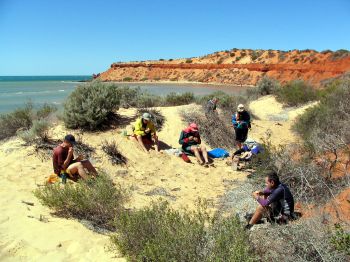
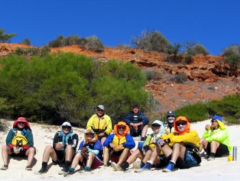
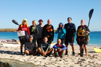
The members for the inaugural paddle were Jim Bramley (experienced Sea Skills), Kelvin Lewis (Advanced Sea Skills), Dave Oakley (experienced Sea Skills), Rod Coogan (Instructor) and Di Bramley (experienced on-shore support).

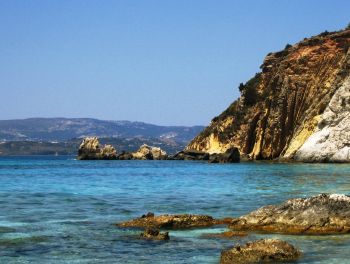
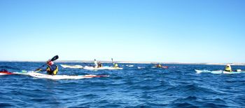
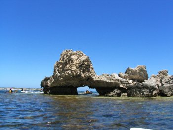
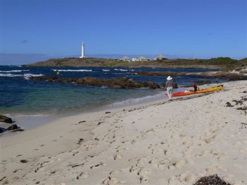
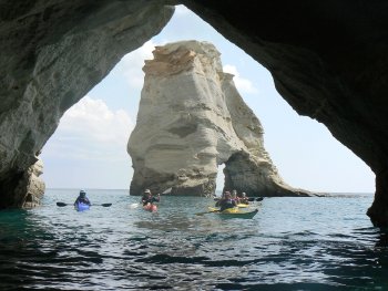
The paddle commences rounding Cape Leeuwin, then passes Cape Hamelin, Cape Freycinet, Cape Mentelle, Cape Clairault, Cape Naturaliste together with numerous other features and surf breaks, most with ‘terminal’ sounding names.

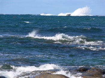
Weather conditions are a significant part when planning any ocean paddle, particularly the C2C as there are few safe landing spots in big conditions. Referring to BOM Wind Roses, February and March are prime times in relation to winds. The weather pattern being hoped for was a minimum of four highs of about 1030 hPa migrating toward southern WA from south of South Africa. The highs at this strength are strong enough to keep the low pressure systems down south toward Antarctica. At 1.00pm, 8 March that’s exactly what we had!

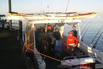
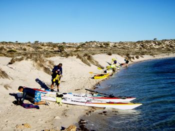
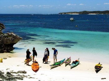
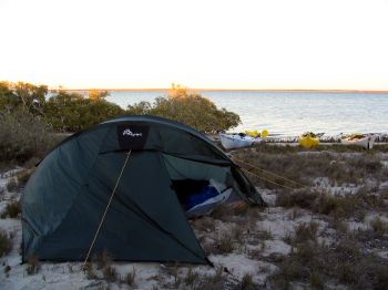
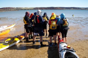
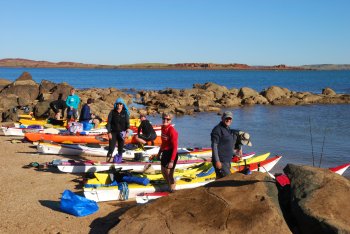
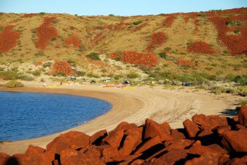
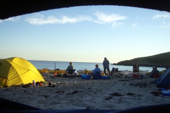
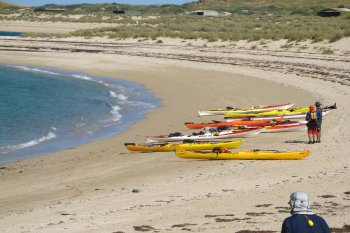
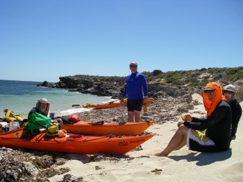
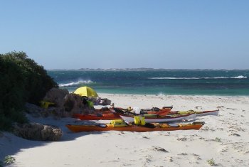
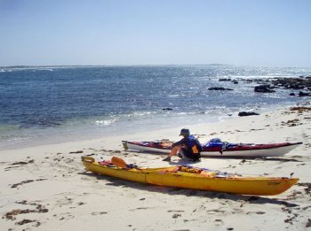
All members arrived at Turner’s Caravan Park, Augusta at varying times Sunday afternoon. After erecting tents and a cuppa, the remainder of the day was taken up with trip discussions and a late evening visit to the launch site.Everything looked good for a Monday launch.

Day 1- Monday, 10 March 2008.
Destination: Hamelin Bay, actual: as planned. Distance: 24km
Weather: E/SE winds 15-20 knots tending S/SE 20-25 knots during the afternoon. Seas to 2.0m, swell to 2.5m.

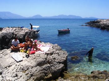
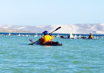
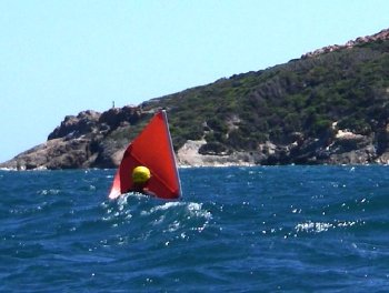
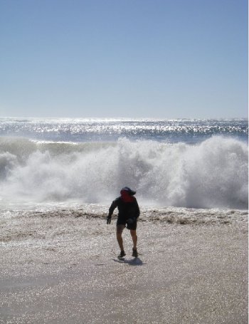
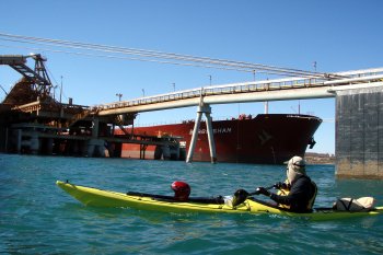
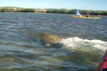
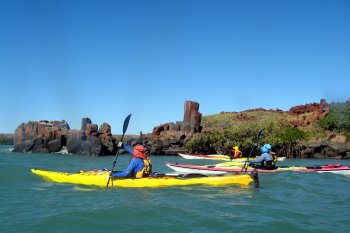
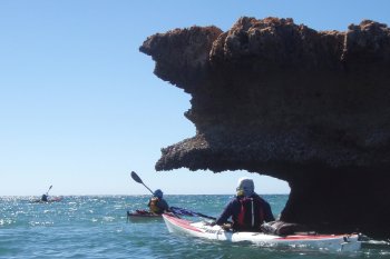
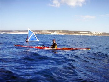
The paddle rounding Cape Leeuwin can be a spooky experience. Big swells from the SE/ SW and the point where they both meet, crashing surf that sounds like a steam train with plenty of rock, reef and bombies to keep you on your toes. Alan Hale joined us at the launch and paddled to the ‘water wheel’ before returning. Seas were of a lumpy moderate swell that allowed us to sail most of the way to a lunch stop at Cosy Corner. Enroute Dave saw a school of dolphins surfing about and I really enjoyed using my new sail which I’d previously tested at the Jurien weekend. On arrival at Hamelin Bay we were greeted by the resident three sting rays who were cruising the shallows. Di was already there with the Bramley camper set up – lucky boy that Jim!

Day 2- Tuesday, 11 March 2008
Destination: Conto’s/ Bob’s Beach, actual: Kilcarnup. Distance: 33km
Weather: E/SE winds 13-18 knots tending 18-23 knots during afternoon. Seas 1.5m, swell 2.5m.

Launched this morning in good conditions toward North Point where we paddled amongst the rocks and boulders. Passing North Point, Jim decided to do some trolling. Cast his line but the only thing he caught was his sail!

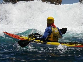
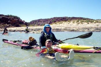
Lunch stop was around the surging surf of Cape Freycinet into the lee of Conto’s Springs. Rounding the Cape Kelvin was paddling close in shore but a safe distance from surging surf on rocks. However, as he passed around ‘a corner’ so to speak, he was in the wrong place at the wrong time and was swept up onto rocks. Kelvin rolled three times but was immediately wiped out each time because he was in a hole formed by surging current and submerged rocks. He was out- Jim was in very quickly to attach a tow line and pull Kelvin’s boat to less turbulent waters. I picked up Kelvin on my bow and returned him to his boat. Damage was minor with small gouges to bow, stern and helmet, slight abrasion to his shoulder and a torn cag. Just as well he was wearing his helmet. We had lunch in the lee of Conto’s with great views all around.

Leaving Conto’s, Dave was paddling closer to shore toward Marmaduke Point where he was nearly caught in shallow waters with dangerously large breakers coming in. As you will read later in this article there is a worrying connection between Dave, shallow water and big breaking waves. At this point we paddled about 1km out to sea just to be sure of no more surprises. We by-passed cappuccino at Gnarabut because it was just too big to get in safely. Jim, the coffee magnet, was disappointed, however within a few kilometres he was about to make a starring splash!.

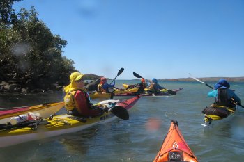
Approaching Cape Mentelle we were paddling in large cresting swells when an unexpected set rolled in. “Wave” was yelled and we all headed seaward managing to miss the break. Jim was not so lucky. He was trapped, braced the first breaker, thumped and capsized by the second. Jim’s first roll attempt failed because the turbulent aerated waters provided no support. By this time the third wave was just about on him when he successfully rolled and managed to sprint paddle just beyond its clutches. Dave, Kelvin and I were relieved, Jim probably was too.

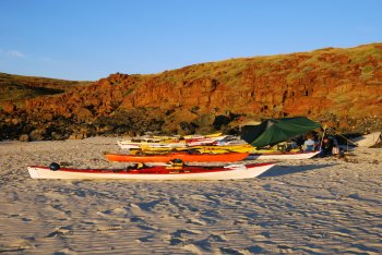
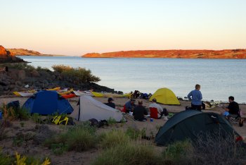
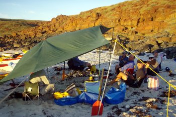
The path into Kilcarnup had us paddling 3 metre faces in through the surf break and around the reef. Because of high tide and strong winds there was just enough space between rocks to camp.

Day 3- Wednesday, 12 March 2008
Destination: Cowaramup Bay, actual: Canal Rocks. Distance: 33km.
Weather: S/ SW 15-20 knots, Sea 1.2m, Swell 4.0m

The launch from Kilcarnup was highlighted by a pod of surfing dolphins. What a great sight to start to a big swell day. A short distance out, Dave said he felt he had been bitten by something. There was a very red lumpy rash on the inside of his elbow. Most likely an insect or spider had crawled into his paddling top the previous night. The stinging slowly subsided with no further problems.

The 10km paddle to Cowaramup Bay (Gracetown) was in building conditions and surfers were out in force. We had to paddle a wide arc around South Point to dodge some very intimidating surf. At Gracetown and headed directly for the General Store for a well earned early lunch. That consisted of juice, coffee, pies and pasties. We were hungry, to our surprise, Dave ignored the lettuce leaves and carrot sticks to woof down a vegetable pastie. This was a big day in more ways than one!

It was 18km to Cape Clairault (Injidup) and we paddled this section with one eye ahead and the other firmly out to sea. The swells were big and the surf breaks pumping. It was impossible to miss Moses Rock. The splash of the breaking waves reached to the cliff horizon. It was huge and thankfully we were a safe distance from it. However, just around the corner was the shore break at Injidup. As with entering Cowaramup Bay we had to paddle a wide arc again around Cape Clairault to avoid the huge surf breaks.

The beach at Injidup Point is steep and was nothing as I remembered. The beach was completely covered with surging water to the base of the sand dunes and vegetation. There was a very intimidating shore break that dumped directly on beach sand. The decision was to land and discuss options and to rendezvous with Di Bramley. Adrenalin was pumping as we approached that dumping shore break. Individually we waited for the lull between sets then quickly and cautiously paddled in, stopping in near knee deep water to let dumpers pass under us and paddle in on their backs to be swept up the beach with the surge. Unfortunately this is where Dave, big swells and shallow water come into play. Dave had paddled into position, to let a swell pass under him. Problem was that swell just kept getting bigger and bigger and within a second he was trapped. It looked as though he had a tonne of water land directly on top of him.

Still in his boat, he braced, was crunched and appeared to have his kayak swept over him in only centimetres of water. It was a very disturbing sight. We instantly lunged for his boat as he was being rapidly sucked out into the path of the next dumper. Dave emerged from his boat in true James Bond style “shaken but not stirred”. By this time Di had joined us to advise the whole beach was being pounded by huge dumpers and of 35 knot NW winds tomorrow. Decision time: it was late in the afternoon, no satisfactory tent sites, exposed beach, conditions visibly building and discomfort guaranteed.

A radio call to ACRAM confirmed winds and a strong wind warning issued. The decision – launch (through that shore break) and paddle 5km to the safety of Canal Rocks – quickly. The launch order would be Kelvin, Rod, Dave and Jim. Kelvin lined up on the steep beach with the rest of us ready to push him off. The lull came, he was off and out successfully. This pattern was followed for all launches however for Jim, he only had one remaining person to assist him – Di. They had to wait at least 10 minutes for a lull between the huge curling dumpers, and then it was one big push to get Jim clear.

Dave and I held station off the beach waiting for Jim to launch. A two metre wave caught us by surprise; we turned and paddled at it. The wave broke directly onto our bows and we disappeared in the soup, and fortunately came out the other side still upright. It was a hasty paddle to Canal Rocks.

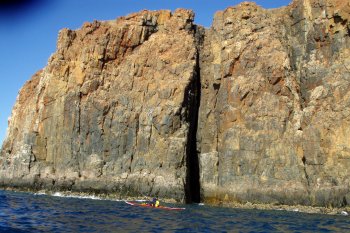
Di was waiting for us when we arrived. In big swell and wind, Canal Rocks is really a spectacular sight. We shuttled boats and wet gear to the Caves Road Caravan Park for a layover day.

Day 4- Thursday, 13 March 2008
Destination: Injidup Point, Cape Clairault, actual: Bad weather, layover day at Yallingup.Weather: NW winds 39 knots, sea 3.0m, swell 4.5m

Warm showers, tent site with no sand, picnic tables at hand, cappuccino and the best egg burger ever not far away, sleep in and the Bramley camper nearby. We did enjoy the day off. Checked, cleaned and dried gear ready for launch tomorrow. Went to a viewing point overlooking Smiths Beach and Yallingup- there’s no way anyone would want to be out there today. The forecast for Friday was looking good.

Day 5- Friday, 14 March 2008
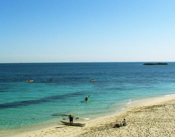
Destination: Bunker Bay, actual: as planned. Distance: 21km. No stops. Weather: E tending N at 11 knots, sea 1.5m, swell 4.0m.

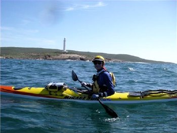
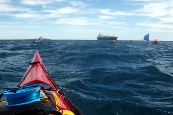
We returned to Canal Rocks to continue in good weather and large swells. The main highlights being the approach to Sugarloaf and rounding Cape Naturaliste. The breaking waves at Sugarloaf were pumping so we kept a wide path of them and the three bears surf break nearby. I did not want any mishaps on our last day. Rounding Cape Naturaliste was in high and sometimes tricky swell conditions. Once past Naturaliste we paddled to avoid bombies and reef on the approach to Bunker Bay. The landing at Bunkers was text book and as usual Di was there to greet us.

Conclusion

I was fortunate to lead a group of very experienced paddlers who have the ability to apply their skills instinctively. If you want to pick up good information then make sure you paddle with Dave, Di, Kelvin or Jim sometime.

The C2C is a great adventure for the experienced and prepared paddler. I believe this is a trip should be scheduled once a year specifically for those paddlers who are prepared to continue improving their skills and build upon their bank of experience.

[/vc_column_text][/vc_column][vc_column width=”1/2″][vc_column_text]

Diane farewelling Dave at Cape Leeuwin – photo Rose Hale

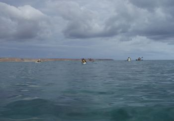
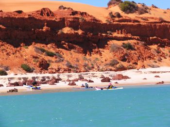
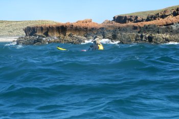
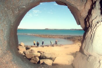
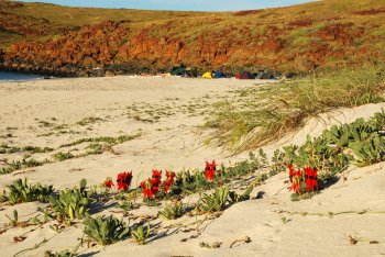
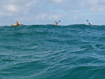
Cape Leeuwin, paddlers just visible top left – photo Rose Hale

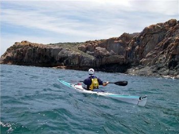
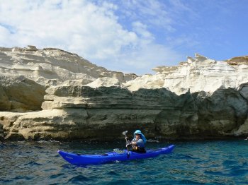
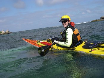
Rod approaches Cosy Corner – photo Kelvin Lewis

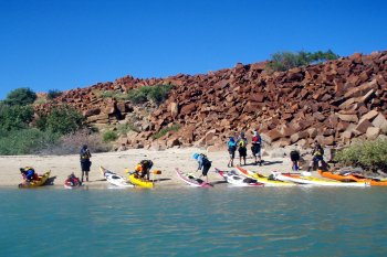
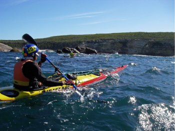
Jim and Kelvin entering North Point – photo Rod Coogan

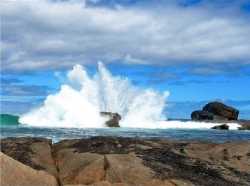
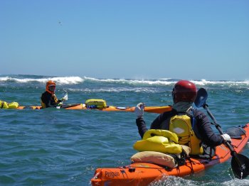
Indijup Point shore break – it was nasty! – photo Rod Coogan

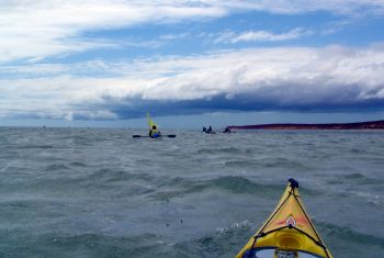
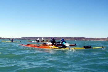
Jim approaches Sugarloaf in 4m swells – photo Rod Coogan


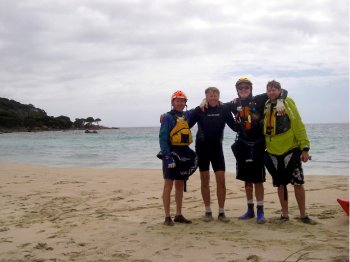
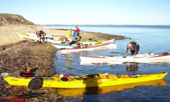
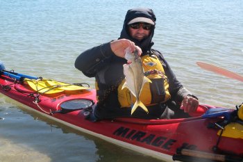
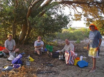
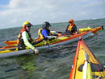
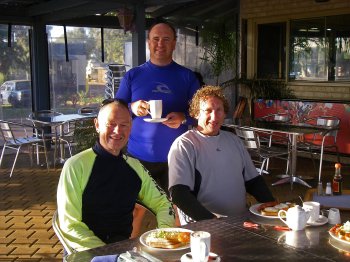
Dave Oakley, Jim Bramley, Rod Coogan and Kelvin Lewis – photo Di Bramley

Things observed, things to improve
& just plain things ……..

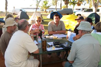
The following points and suggestions come from the inaugural paddling team over coffee (lay-over) Thursday at the Caves Road Camping Ground.

The list is not definitive and is in random order.

  • Know your self-rescue and assisted rescue techniques so you can apply them instinctively. Everyone on this trip could and did!
  • A hands free bilge pump is compulsory plus back-up method/s.
  • A correct fitting helmet is compulsory. If in doubt, ask Kelvin. His saved him from injury.
  • Understand group dynamics. They change with conditions and from day to day.
  • Jim’s camp chair is a hazard! It spontaneously collapses.
  • Carry a repair kit for your boat, tent and sail.
  • Bring only known, tested equipment. If it’s new and not tested, don’t bring it!
  • This trip is for paddle fit and experienced self reliant paddlers.
  • Each paddler must be aware they are responsible for their own safety and must not be dependent on other group members putting themselves at risk.
  • The group will always assist however, only when it is safe to do so.
  • Don’t let Dave near big waves and shallow water!!
  • A bomb proof roll in a loaded boat is compulsory. Screw preferred, Pawlata satisfactory.
  • Trip Grade: Sea Skills plus meaningful ocean paddling experience.
  • Satellite phone essential with minimum two VHF radios and spare batteries.
  • Following discussion, the leader has final say in relation to group safety. There were no problems on this trip.
  • Sailing experience in 15-20 knot winds and paddling following seas over 20 knots.
  • Update weather reports daily. We nearly got caught!
  • Be prepared to change plans at any time- we had too late in the day at Injidup beach.
  • Stick to the agreed communication plan with support vehicle. To our embarrassment, we didn’t!
  • Don’t trust ‘text messages’ as being received unless they are replied too. Happened to us!
  • Boats with skegs only. Hmmm the jury is still out on that one!.
  • The General Store at Gracetown is a great place for an early lunch! Even Dave enjoyed a vege pastie in place of his usual celery sticks and lettuce leaves.
  • Organizing brekkies, lunches & dinners in daily plastic bags seemed to work well. ie: daily brekkie bags all stored in a dedicated brekkie dry bag.
  • A mixed group of paddlers and sail assisted paddlers might create group speed problems.
  • Exercise care toward the end of your paddling day- that’s when ‘things’ are more likely to happen!
  • On this trip it is important that everyone paddles at the same speed.
  • Having a support vehicle in case of evacuation is a very good idea.
  • Consider double bagging important items eg: spare warm clothing.
  • Take a small container of Vaseline for chafing. It has other uses!
  • Surf landings and launchings to high standard of proficiency in heavy conditions.
  • Minimize deck clutter: eg- Forward Deck- Deck Bag stowing an easily assessable 15m tow line, and usual sail rig. Rear Deck: Break down paddle.
Dampier Archipelago

Dampier Archipelago

Russ Hobbs

The 2008 trip to Dampier, led by Phil Evans, was a great success. The weather was kind and we all saw heaps of wildlife. Even better was the company, with a highlight being great conversation around the dinner patch. Below is a selection of photographs. The full trip report can be found in the Newsletter (see Issue 71 WA Seakayaker).


Briefing the night before the launch– photo Steve Foreman

Alan at the the ore pier – photo Tim Hale

The dash to get away from civilization – photo Martin Burgoyne

Has Helen forgotton her kayak?– photo Martin Burgoyne

Sea eagle on Burrup Peninsula – photo Alan Hale

Morning briefing at Burrup, day 2 – photo Alan Hale


Phil and Russ in the mangroves at Dolphin Island – photo Steve

Sunrise at Tozer Island camp – photo Russ Hobbs

Turtle in shallow passage NW Gidley – photo Tim Hale


SE corner of Gidley Island – photo Steve Foreman


Alan in Flying Foam Passage – photo Helen Cooksey

Crossing Mermaid Sound to Malus Island – photo Tim Hale

Malus Island camp– photo Helen Cooksey

Malus Island camp – photo Russ Hobbs

Tim under the cliffs at Malus Island – photo Helen Cooksey

Tim in whaler’s cauldron from 1870s – photo Steve Foreman

Alan rounding rock stack at Malus Island – photo Steve Foreman

Manta ray at Malus Island – photo Martin Burgoyne

Coral reef near Boiler Rock – photo Steve Foreman

The view from Sam’s castle– photo Tim Hale

[/vc_column_text][/vc_column][vc_column width=”1/2″][vc_column_text]

Packing up ready for launching at Dampier – photo Russ Hobbs

Kevin at the iron ore pier at Dampier – photo Martin Burgoyne

Tea break across from gas terminal – photo Helen Cooksey

Short break on Burrup Peninsula – photo Alan Hale

Late afternoon at first camp, Burrup – photo Russ Hobbs

Aboriginal rock art on Dolphin Island – photo Steve Foreman

Tim had the only catch of the day – photo Steve Foreman

Helen sailing down shallow passage NW of Gidley – photo Steve

Steve on western side of Gidley Island – photo Tim Hale

Paddling back into Flying Foam Passage from Gidley – photo Steve

Helen at Angel Island – photo Martin?

Judy sailing across Mermaid Sound > – photo Martin Burgoyne

Desert pea (Wildampia formosa) at Malus – photo Russ Hobbs

Martin’s view of the world at sunrise– photo Martin Burgoyne

Whaler’s Bay Malus Island – photo Steve Foreman

Phil rounding rock stack at Malus Island – photo Martin Burgoyne

Manta rays at Malus Island – photo Martin Burgoyne

The whole crew at Malus Island – photo Russ Hobbs

Phil, Tim, Roz and Helen at Sam’s island – photo Steve Foreman

The girls at Sam’s castle – photo Martin Burgoyne

Kayakers Marooned on Island

Kayakers Marooned on Island

Rod Coogan

I look forward to the Club’s Jurien Bay long weekend trip because something always happens that makes that particular year’s trip different from others. This year was no exception.

Steve and I arrived at Jurien about 7.30pm and headed straight to the pub for a meal. John Radovich (aka: Rado), Paul Cooper and Alan Hale (aka: Al) had arrived earlier and were set up for a good night’s rest. Regrettably the Poms next door (actually Scots) were not. They were determined to enjoy themselves into the wee hours of the morning. Paul, a very patient person threw the towel in at 12.30am and spoke to them “ ^*&##*!!!”.
They very promptly apologised and as promptly continued on their partying way. This finally ceased at 2.30am.

Saturday, 1 March:
Forecast- S/SE winds 13-18 knots during morning turning SW 15- 20 knots for the afternoon.
Aim: To Boullanger Island, Western Reef area, Escape Island and camp Hill River.

Following brekky and strictly observing “Gentleman’s Hours” we promptly launched at 9.30am. We all loosened up paddling to Boullanger where we explored its embayments and Western Reef area. Al and Steve had a quick surf on the reef area, where Al was hit and capsized. That didn’t look good but he did finish off with a successful roll. With winds forecast to 20 knots, we were determined to land at Escape Island. We paddled to the exposed southern end of Escape to find a small landable beach, but with conditions building all agreed a launch from that spot might be tricky business. We promptly paddled to the northern lee side where a safe sandy beach was found for a lunch stop. Following lunch and a brief surf and play it was off to Hill River for the night’s camp. Conditions were ideal with very clear warm water, blue skies and a 12knot beam wind.
About 2km south of Escape we did some practise rescue drills, rolling and assisted re-entry. The thought being always practise in waters and conditions you are likely to paddle in. Loaded boats were successfully rolled; indeed Paul embarrassed us all making his roll look too easy!. Steve opted for a wet exit which gave us the opportunity to practise emptying the flooded cockpit of a loaded boat. It took two support boats to accomplish the task. It was hard work but good practise.

By this time the day’s temperature was high which prompted Rado to suggest camping in the treed beach area opposite Essex Rocks because there would be no shade at Hill River. We immediately altered course.

Once tents were pitched everyone retired to the shade for a cuppa, nibbles and stories that included the usual exaggerations. The company was excellent, the shade very welcome. The occasional bull ants not so welcome! Everyone slept soundly, which was just as well with what was to follow the next night.

Sunday, 2 March:
Forecast- Strong Wind Warning, SE winds 18- 23 knots turning SW 20-30 knots for the afternoon.
Aim: To Essex Rock, Boullanger Island, Favourite Island and camp North Head.

With conditions building and Essex Rocks only 4km away, we set off in manageable wind and wave. We paddled an off-set course allowing for wind and about 3km out we stopped to assist Steve who was having trouble with his foot rest. Paul and I supported his boat while he put his head down to make adjustments. I take my hat off to anyone who can do that in a bumpy sea and not throw-up!

The approach to Essex Rocks is interesting because there is a rock formation that resembles a submarine wreck. You will paddle to within 50 metres before realising what it actually is! Have a close look at the photos to find the ‘finger’ rock directly behind the ‘submarine wreck’. It conveys an interesting message from Mother Nature.

Essex Rocks rewarded us with 1.5m breakers, picturesque reef conditions, good surf rides and a very swift current running about the reef to practise in. Steve took a tumble in the current that runs over reef in very shallow water.

He failed to rol l- something to do with his helmeted head bouncing along the reef bottom. Holding his boat in one hand and my bow in the other, we drifted into less turbulent waters where a text book bow rescue was executed.

With the thought of strong afternoon winds we headed to the northern end of Essex Rocks for a rest stop before tackling the short but menacing passage to the safety of Boullanger Island.

Al was in the lead and paddled around to the lee side of Essex to be greeted by over 20 of the friendliest seals you have ever met. Without doubt the best ‘seal reception’ ever!! These guys swam close-in around boats, bumped into boats, mouthed paddle blades and just plain skylarked all over the place. Mind you we did not lose sight of the two BIG boys on the beach. On top of all that we also practised bracing into beam surf and some play ourselves. It was hard to leave our new mates but the thought of strong afternoon winds prompted our departure.

The passage to Boullanger is only 1.5km but we had to dodge ‘steam train surf’ all the way. I recall looking to my seaward side to see Paul brace into a cresting wave. Approaching Boullanger, Rado was surfing, took a tumble and rolled up that fast I wasn’t sure he capsized in the first place!

We all enjoyed the lunch stop at Boullanger.

The paddle to Favourite Island was as predicted with a strong following sea. The route past Boiler and Harper Reefs was thankfully restricted to large lumpy swells. Al demonstrated good boat control in these conditions with his ‘packed high rise’ stern, together with no rudder or skeg.

Once landed at Favourite Island the wind was over 20 knots and strengthening. A radio call to Jurien Sea Rescue confirmed SW winds 20- 30 knots and strong wind warning issued. Monday’s weather being SE/SW 15-20 knots early morning rising to 20-30 knots later that morning .. … What to do!!

After discussing options and consequences, the group decided to camp overnight on Favourite. Jurien Sea Rescue were advised and we started looking for sheltered tent sites. A task easier said than done!!

The island is basically elevated rock about 250 metres length with a very exposed undulating top littered with deserted bird nests, patchy low scrub and some very nasty ‘blow holes’ in the making. A fall into one of those would result in serious injury. There is a large tidal sand spit at the eastern end of the island. We camped in different possies on the sand spit at the base of the island rock. The wind was now really strong with sand blowing and swirling from every direction. Boats were pulled up as high and dry as possible and we settled in for the night watching the tidal surge form mini lakes in front of us. One surge got to 2.5 metres from a tent.

No one slept well – the partying Scots at the caravan park we thought were bad enough but were no comparison to the noise the birds on Favourite made ALL night long and to the continual sand blasting we took.

Monday, 3 March:
Forecast- SE/SW 15-20 knots early morning, SW 20-30 knots later morning.
Aim: Get home!

Word was out and travelled through the camp like wildfire- “We sail at dawn”. If we were to get off the island we had to take advantage of the morning forecast winds. Everyone was up and packing at 5.00am. We were under way before dawn and luckily for us the wind had died back making for an easy paddle back.

Once on terra-firma, Al and Paul headed for the showers while Rado, Steve and I made for the beach café for breakfast. Ahh, the aroma of scrambled eggs and fresh coffee at dawn- excellent!!

Things observed and things learnt:

• Carry a radio and never be hesitant to use it.
• Check your footrests, rudder, back band and other adjustments before every launch.
• Steve’s paddle shoes stink.
• Have another paddler check your boat immediately prior to launch. They may find something you’ve missed.
• Webbing stretches when wet. You may need to allow for that.
• Carefully check hatch covers are seated correctly.
• The seals at Essex Rocks are very social.
• The birds on Favourite Island are very noisy.
• Enjoy the your paddling experience and at times its solitude. But be aware not to paddle too far from the main group. Keep within communicating distance, you may be needed to assist in an emergency.
• Sails are great.
• The practise you do will help yourself and others in an emergency one day.
• Carry a repair kit for your boat and tent.
• Thanks to Al, Paul, Steve and Rado for their contribution that made this a great paddle.

Conclusion:
A terrific Jurien paddle! Good to challenging weather conditions, excellent camaraderie, thrills, spills, rescues and those seals. A trip that had something for everyone. I’ll be there next year!

[/vc_column_text][/vc_column][vc_column width=”1/2″][vc_column_text]

Al, Steve, Paul and Rado on Escape Island – photo Rod

Al signals Paul at Essex Rocks – photo Rod

Saturday night camp on mainland opposite Essex Rocks – photo Rod

Paul, Steve and Rado en route to Essex Rocks – photo Rod

Rod at Essex Rocks – photo Rado

Rod and Paul assisting Steve for minor repairs – photo Rado

Al and his mates at Essex Rocks – photo Rod

Camp on Favourite Island – photo Rod

Jurien breakfast – photo anon

Two Weeks with Sandy

Two Weeks with Sandy


Now there was an idea! Why don’t I join Sandy Robson for part of her south coast adventure? She was planning to paddle from Esperance to Augusta or possibly round to Hamelin Bay. It was to be another piece in her quest to circumnavigate Australia. I didn’t really fancy the full trip and living out of a kayak for four weeks, so I suggested going as far as Albany with her. Val would come down and pick me up, and we would then be able to have a short holiday along the south coast. Matt Erkins was also keen to join her though he had decided to do the full trip.

Sandy would be doing the trip anyway, so it was agreed that we would all be self sufficient, which would give us the option of dropping out without upsetting her plans. She had done an immense amount of planning and preparation for it. Her detailed annotated charts, with aerial photographs from Google Earth of all possible landing/camp spots, were exceptional and a real learning point for me. We put together emergency service contact details, enlisted the help of a range of friends for food drops, accommodation, and assistance should we need it, and Sandy arranged to check in with Les Allen every evening. Les had also loaned me a sat phone.

Sandy had convinced Matt and me to fit sails to help with some of the longer sections. It was an aspect I had long thought about, and now in hindsight I wish I had fitted one earlier. It adds a whole new dimension to kayaking!

We had overheating problems with Matt’s car on the way down to Esperance, which made for a longer and slower journey. It knocked a day of the start while he arranged to get it fixed, but it gave us time to log in with the local sea rescue and do some final bits of preparation. We had an early start after a bit of a slog through the camp site with kayaks and all our gear. We rounded Dempster Head and Observatory Point, paddled past the wind farm on the Ocean Drive and the sparkling white sand dunes of Thirteen Mile Beach and arrived mid afternoon at the secluded and sheltered Butty Harbour Bay. It was a superb spot, unfortunately spoilt by a disgusting, litter filled fishing shack. Matt had had a tough day in the big swell as his boat was feeling particularly unstable. His efforts to keep it upright had put a big weal on his side – he was not at all happy and was talking of dropping out.

Voracious mosquitoes gave us an unpleasant time packing up the next morning. We went out round Butty Head’s small off-shore island as the swell through the gap looked rather too large for comfort. The swell and seas were bigger than the previous day and there were a few bombies around to focus the mind, but at least we had a favorable breeze. Sandy and I were able to use our sails, not so Matt who was still really unhappy with the stability of his boat. We were aiming for Quagi Beach which would provide Matt with road access if he did decide to pull out. I had used my pump intermittently all day, but as we approached our destination I was aware of more water splash on my calves. I thought that carrying the large water bag under my legs was acting as a dam, and preventing water that was coming on board getting to the pump. But there was only a couple of kilometers to go so I would look at things once we landed. Sandy overtook me on the last stretch and I struggled to keep up – was I really that tired? Once we landed the reason for my slow speed was obvious – my kayak was full of water. There was water in every hatch, and ‘Yes’, it had also managed to enter all my dry bags. But it was early afternoon and there was a strategically placed slab of warm rock on the beach to dry things out on. Water had also got into the pump’s battery box which had a melt down. Both terminals being totally dissolved in the evil looking liquid dripping out of it!

Matt did decide to pack in, but he still got up with us the next morning to push us off. He eventually managed to engage the help of an eccentric ‘grey nomad’ to get him back to Esperance. I used two spray decks to stem the water flow into my boat that day, and I also made sure the bung was in the pump outlet. I had been most upset to find that the pump didn’t have a one way valve after all!!

The updated morning weather forecast suggested that winds would be favorable, though Sandy did say that she didn’t usually paddle in the forecasted 3 metre swells. So it looked as though it was going to be an interesting 40+ km day!! The wind was good and we were able to use our sails to great effect. Though we both found ourselves turning sharply out to sea as we caught the sight of some larger sets coming in – exciting! As we approached Munglinup it took a little while to decide which of the three possible beaches we should land on. The bombies and swell made it difficult to see which was the safest. But we got in OK to a rather narrow beach which prompted us to move the tents as the tide came in.

Next day would be a shorter paddle to Starvation Bay, so we managed a lie in until 5 am! It was an interesting paddle as the chart said UNSURVEYED. Again the swell was big and there were plenty of bombies to focus the mind. We passed by three uncharted islands some with seals on them, and then landed on the fourth for lunch. It even had a sandy beach, but no room for camping. Our sails helped us make a quick passage to Starvation Bay and an excellent camping spot, that we had to ourselves. It had a large fixed table with benches and a ‘his and hers’ toilet block. This all proved most welcome as in the end we camped here for three nights. With strong S/SW winds, thunder storms, and 3.5 metre swells forecast over the next few days we stayed put! The evening thunder storms were spectacular but started a number of bush fires that we could clearly see.

On the fourth day, and with a semi favorable forecast of light S/SW winds in the morning picking up to 20 -25 knots in the afternoon, we decided on a very early start to try and beat the wind to Hopetoun. We were up at 3.30 am and checked the updated forecast – no change, so we decided to go. The light from my headtorch just managed to pick out the reflective strip on Sandy’s boat as we headed out into the quiet gloom, and around the rocky spur of Powell Point.

It was to be a 46 km paddle with only a slim chance of a landing at Mason Bay if we could get in through the swell. Initially we made good progress going wide round Mason Point to miss the bombies and intermittent breakers – only 31 km to go. Around 9.30 the wind picked up, considerably earlier than expected, and it became slow progress. At 10.30 we talked about going back, but decide to try it a little longer. At 10.45 with 15 km left to go we agreed to turn back. Almost immediately Sandy said my rudder looked funny, and as I turned round to look at it, it fell off! She stowed it under the deck lines and we set off again. But oh dear, I could only do three or four forward strokes before I needed a big stern rudder to lever the boat back on course. My boat was weather cocking badly and no amount of lean helped the steering, what’s more the rudder strokes just about almost stopped me. After 2 hours of this we rounded Mason Point – 12 km to go, but my shoulder was really starting to ache, and progress was now painfully slow. I was tired and really concerned about the consequences of capsizing. Sandy was also getting cold as she was constantly having to wait for me.

A fishing boat a couple of kilometers out caught my eye, and I decided to head for it. Despite constant paddle waving and a call on the radio we got no response. Sandy tried to see if a tow would help me, but not really. While it did pull me back on course with a jerk, a few more strokes from me and we had a couple of metres of slack. Now if I hadn’t paddled at all, it may have kept things tight. But we were almost at the boat, and soon realized why we had been getting no response. It was an abalone boat and they had a diver down. They kindly agreed to take me and my kayak back to Starvation Bay, once they had done for the day. The diver had quite a surprise when he surfaced to a kayak straddling the rear deck. Sandy paddled back to the bay. We shared our dwindling food supplies that evening and discussed the eventful day.

Matt picked me up the next morning, but with favorable easterly winds Sandy had a quick paddle to Hopetoun. We watched her progress along the coast and met up at Hopetoun. We had two more days of unfavorable winds and sat around getting increasingly bored. Sandy and I decided to go for Point Ann on the third day, for what would have been a 57 km paddle. We got up at 3.30 am started to pack, and then listened to the updated weather forecast. Stronger 25 knot tailwinds and 2.5 meter swells were now forecast for the afternoon. There would be no turning back, and landing could be exciting to say the least. There were bush fires in Fitzgerald National Park so no vehicle access was allowed and we just might be stranded there. So we decided to go back to bed.

Matt and I came home. We dropped Sandy off at Bremer Bay, where she progressed down as far as Riche Point before getting a lift to Albany. After a few days R&R in Albany she set off westward again.[/vc_column_text][/vc_column][vc_column width=”1/2″][vc_column_text]

Sandy under sail around Shoal Cape – photo Martin Burgoyne

Bushfire near Munglinup – photo Martin Burgoyne

Sandy on uncharted island west of Powell Point – photo Martin Burgoyne

Learning Points

  • Laminate and annotate your charts, and topographical maps into manageable A4 double sided sheets. Include Google Earth aerial pictures of landing spots round the edge.
  • Mosquitoes are voracious at 4.00 am and are attracted to head torches.
  • Get into paddling gear in your tent
  • Eat early morning breakfasts in your tent
  • Pack as many bags as possible in your tent
  • Put insect repellant on all exposed skin
  • Turn off head torch to dismantle your tent and to do the last bit of packing.
  • I don’t like pre-dawn starts.
  • Locktite or superglue rudder pins, which may just come undone. Check each others so you know how they fit together in case you have to put one back in an emergency.
  • Paddling without a rudder with a strong following wind blowing over a rear quarter is difficult. Counteracting weather cocking is extremely tiring, and puts a lot of pressure on one set of muscles.
  • Towing in a following wind, when the kayak being towed is weather cocking is not productive.
  • Remember most electric water pumps don’t have a one way valve. Make sure you keep the bung in, even if the outlet is well above water.
  • Double dry bag any electrical gear.
  • Include spare food for days when you maybe weather bound, and then add at least another day’s rations.
  • Consider cutting down on the water carried in bags by taking some foods which are already hydrated.
  • Water carried in smaller bags makes it easier to distribute weight around your boat as the load decreases.
  • Think carefully about what you put in your day hatch. Practice getting into it. Are you able to get at and put on extra clothes if it’s cold, or take off and store clothes if it is too hot?
  • A sail on your kayak really adds to the pleasure of kayaking. It adds interest, increases speed, and reduces effort.
  • Not all fishing boats monitor their radios.
  • A 90 degree feather on a paddle really increases headway when paddling in to the wind.
  • The southern ocean has BIG swells!
Paddling in Greece

Paddling in Greece

Judy Blight

I was lucky enough to have a friend who, after selling his house for quite a lot of money decided to shout half a dozen friends the air fare to any destination in the world. Where would I go? The Arctic had always interested me but I felt the cost of that trip might end our friendship. I had paddled in Canada last year so for a change in continent I chose Greece. I had always been interested in Greek Mythology and the return journey of Odysseus from Troy to Ithaca had stayed in my imagination-so a sea kayak trip in that area was one of my choices. I went on the web and found a group called Monte-Nero activities and proceeded to look for a trip in the Ionian group of Islands. I settled on the trip around part of Kefallonia and the island of Ithaca or Ithaki. First time in an area it’s often best to go with a company as you learn the pitfalls and rules associated with paddling in that area and also how easy it is to camp or to hire kayaks.
The other trip that interested me was the trip in the Aegean Sea from the island of Milos to Santorini. The trip is for more experienced kayakers like us as it has 20 km. Crossings and at time it can have very strong winds. Having only recently paddled at Dirk Hartog with 3 consecutive big wind days I elected the more protected area in the Ionian Islands.

I am not going to give a day to day description but can definitely describe it as one of the greatest holidays I have ever had. The weather was hot, the sea was brilliant blue and perfect for swimming and snorkelling, the trip leader was friendly and professional and the fellow paddlers younger than me (not difficult) and wonderful company. A husband and wife from Denmark, a German fellow and a Swiss German guy. Fortunately, we all shared a love of beer, wine and good food.

We visited small fishing harbours and stayed in small tavernas and we also camped on deserted beaches (mainly small pebbles).The small boat accompanying us carried tables and chairs, tents, thick sleeping mats and delicious foods. Somehow, the Greek salads in Greece taste so much better. One of the things I really liked was the fact we had no flies and only a few mosquitos. Yes-we did have the odd wasp wanting to share our food but not having to wave your hand around your face or cough out the odd fly that always seems to find the mouth, was heaven.

The actual paddling was easy and I really had to slow my stroke down. I have spent so much time trying to keep up with men in Perth that as soon as I hit the water I become frenetic. It was great to ease along and explore the wonderful caves and look at the amazing cliff faces that characterize the beautiful Ionian islands. I say the paddling was easy but we did have a couple of days in the middle of our 8 day trip when the wind came up and flew down the mountainside and sped along between two islands to give us a really difficult time. Along with one swim to Rottnest accompanying a paddler I did in over 25 knots, this was similar. The wind was side on and so you had to lean well over to prevent the kayak from tipping—it was hugely strong and the force of the wind waves was great. Other members of the group thought they were big waves but—no—they were not like our big waves that build up over great distances. I kept quiet though because it sounds sort of arrogant to say “you should see our waves at home sometimes”.

It was fantastic to be able to practice rolling in the warm water and to practice rescues. I must say they were pretty impressed with my re-entry roll. (Wait till I perfect the hand roll next summer.) Our trip leader, Pavlos (of course that would be his name), gained his certification in Britain and so had a bias to the British way of doing things. I still can’t figure out why you have to push off with your paddle in one hand and other hand on the sand when you take off from the beach. We used Prion kayaks which seem to be popular over there but I was pleased I took my Werner paddle with me. It did cause a few glances my way in airports and one man even asked me if it was a machine gun?

Was it better than paddling around Rottnest? I would have to say no. I love the pristine waters we have with the abundant marine life and the variation we have with our big swells and then the crystal clear see-through waters on the outside of Garden Island.

Don’t get me wrong, it was a wonderful holiday and the waters are the bluest I have ever seen but I think they have fished the Mediterranean to death. We did see small fish when snorkelling and the small dolphin that inhabits that region but nothing compares to our stingrays, dugongs and sharks that cruise by us here in WA on occasions or our wonderful large dolphins and whales. Lets keep it pristine.

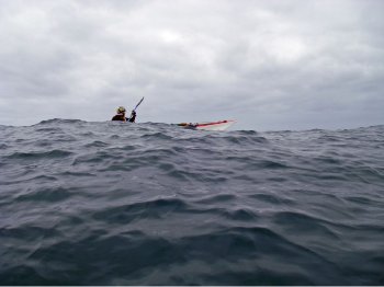
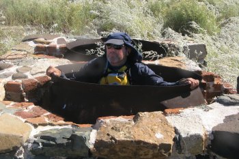
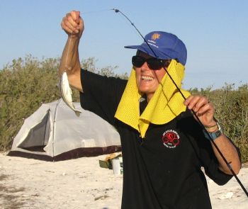
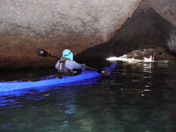
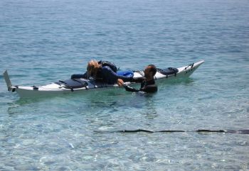
Asking Poseidon for help in hand rolling – photo Judy Blight

Departure point at Assos, Kefalonia – photo Judy Blight

Great snorkeling spot – photo Judy Blight

Near Fiskardo – photo Judy Blight

Typical view from B&B – photo Judy Blight

Limestone cliff at Ithaki – photo Judy Blight

Dirk Hartog Island

Dirk Hartog Island

By Helen Cooksey.

We all met at our booked cabin at the Caravan Park in Denham on Thursday afternoon. I picked up Judy on Wednesday afternoon after she’d done a day’s teaching and we drove as far as Dongara for the night. My nephew, who is a keen boat fisherman, warned us about shoals that extend out from the North East end of Dirk Hartog Island which sometimes have large swells breaking over them forcing boats to take large detour around if they want to get to Turtle Bay. He also mentioned strong north running currents that sweep around both ends of the island. We travelled on to Denham the next day after a stop in Geraldton for last minute supplies.

Jim had spent Wednesday night in Geraldton en route. Martin left home at 4.30am on Thursday towing the club trailer picking up Laurie, Matt and Kevin en route.

Friday morning we were down at the jetty at sunrise. The 10m twin hull fishing charter boat Jim had organised to take our boats, gear and us to Withnell Point, 10ks south of Turtle Bay, looked awfully small. How could everything fit on? No problem. Five boats were put crossways on the overhead canopy and one on top of the other lengthways on the deck beside the hold. Fortunately the sea was calm and there was no wind. We all piled on plus 4 or 5 paying fishing charter people and off we went. The Skipper off loaded us onto the beach around the bay a little from a fishing shack which had a large sea eagle’s nest on the flimsy looking roof. We each paid $170 for the ride over.

By the time we set up camp and had lunch there didn’t seem to be time to paddle the 10km across the bay and around to Turtle Bay and 10km back so we explored the bay on foot and by boat, surfed on some small waves on the point and practiced some Eskimo rolls and self rescue. I discovered an interesting minor complication when I tried to do an upside down re-entry and roll. I found it took longer to thread my legs into the cockpit under water with a 10 litre water bag strapped to the floor suspended in the water. The things you don’t know about until you practice! In the late afternoon the fisher people got their gear out. Kevin took to his boat with his squid jigger, Jim tried his luck with big hooks and heavy line and Matt and I used light gear and small hooks. We won the tally catching small whiting, flathead, bream and trumpeters on Friday and Saturday evenings. Fish was on the menu for the first 2 nights.

The most disappointing thing about our idyllic camp site was the amount of rubbish in the bush. It was everywhere we set up camp along the island. Everyone who camps on the island is charged $16.50 a night (we paid $50/head) but there are no services given for the charge. Behind our camp, among other things we found a toilet seat and a kitchen sink which was promptly put in Judy’s boat.

Kevin also found some drums and star pickets which he tied his tent to as he’d forgotten to take his tent stays. The only problem was they went bang in the night when he moved. After we went to bed the first night the camp site was over run by small crabs. They scratched around outside your tent and on anything metal like stoves that had been left out. Judy kept reaching out of her tent and shouting at them in murderess tones to go away as she attacked them with her shoe. I put my ear plugs in and tried to ignore Judy and the crabs.

Saturday the weather was beautiful again. Oily clear calm sea and no wind. We set off across the bay and rounded Cape Levillian close to the beach and into Turtle Bay. Fortunately there were no breaking waves on the sand banks but we could see swells rising on them further out. The Cape Inscription light house was visible across the bay above the cliffs. We didn’t stay too long. Gray clouds were building up and the beach had a high surge. As we paddled back Kevin was about 20mtrs from shore when he suddenly shouted excitedly that he had paddled over a 20’ Tiger shark. He said he could see the stripes and it was longer than his 5.8m kayak. Matt, who was paddling beside him also saw it and said it was as long as 2 doors end to end and as wide as one. That gave us all a reality check and put any thought of practicing Eskimo Rolls out of our heads.
A short while later we saw Martin’s kayak wobble alarmingly as a large Dugong dived under his kayak amid ship then headed straight for Matt amidships creating a huge bow wave. He also had to steady his kayak as it passed under him and headed out to sea.
As we paddled across the bay large black clouds gathered over our camp site. As soon as we arrived back the rain bucketed down. Everyone dived into their tents to sit it out except me. Some read and dosed, one person decided he might as well get stuck into his cask of port while he read. I sat out the storm having my daily ablutions in the warm sea, keeping an eye out for fins. The rain cleared, the sun shone and we emerged from our tents. Matt went around to the point for his daily feed of oysters off the rocks before returning to fish. Jim put his heavy fishing tackle away in disgust because he hadn’t caught anything although something big did take his hook, line and sinker the evening before when he left it set with a Trumpeter on it.

Sunday the wind was blowing from the South East strong enough to blow the dog off the chain. Kevin checked the bay south of the Point and declared the wind was too strong to paddle into. We gladly agreed to sit it out for the day. All of us except Martin set out to see how far we could walk across the island. We slipped and sloshed along a track across a birridah, a salt clay pan, that had water in it from the previous evening thunderstorm then up a rise for a while before deciding some people didn’t have suitable foot wear or long trousers to bush bash across the island so we returned to camp. Martin had his kite out and flew it successfully for a short while. The wind was so strong it broke a string so he had to put it away. We read and watched the sea life in the bay. A 2m shark with a long thin dorsal fin entertained us chasing fish on a sand bank not far from shore. Turtles popped their heads up to look at us occasionally. Judy and Kevin listened to the Dockers game on my little radio which always had good reception. At night we sat around Martins candles standing in sand in plastic sandwich bags and had a “show and tell” of our first aid kits.

Our 11 neighbours in the nearby fishing camp who had arrived on Saturday in 5 boats awoke on Sunday to find one boat missing from it’s mooring. They found it over the far side of the bay on the beach and towed it back with one of the boats. Apart from that we didn’t see them venture out in their boats all day.

Monday the wind was still ferocious but we packed our boats with all our gear which included water and food for the week, tent, chair, stove, fuel, repair kit, first aid, clothes etc. We rounded the point to be hit by 20 knot SE winds on our left front quarter. Judy’s shoulder started to give her terrible pain so Kevin quickly hooked up a tow rope and all the guys took it in turn for 10 to 15 minutes to tow her. By the end of the second rotation they were all really tired. We landed at a wide white sheltered beach for lunch beside a sheep loading race presumably used by the station owners to load their sheep onto the barge to take to Denham. We discussed various contingency plans of what to do about Judy and her sore shoulder. She had been paddling with a high bag on her fore deck with her sail propped up on the bag so her paddling action looked very awkward. She re arranged the bag to her aft deck, put the sail flat on the fore deck and fortunately had no more trouble. We asked some guys fishing off the beach for a weather forecast just as one pulled in a whiting as thick and as long as my arm. Unfortunately they weren’t forth coming with either a free fish or a forecast. The wind had eased slightly but we still made slow progress arriving at Louisa Bay at 5pm. We had started at 8.30am.We reckon we must have had a current running against us as well as the wind. We were all exhausted and in bed by 7.30pm.

Tuesday. We were on the water by 8.30 again. We rounded the point to be hit by 20 knot SE winds on our left front quarter again. We struggled along beside the cliffs with steep sharp waves over head high rising up on our left. You no sooner got over one wave and others rebounded back off the cliff on your right. It was like being in a washing machine. Kevin and I discuss turning back until the wind abated but it would have been too dangerous having those conditions as a following sea so we struggled on. After a couple of hours of these conditions we saw a small beach in a gap in the cliffs. Martin was the strongest paddler and always out in front with a bright orange hat. We were all very pleased to see the orange hat bob over the water towards the beach to investigate the possibility of landing. After careful inspection he waved us in. There were rocks on the shore line and rocks in the water so all the heavy boats had to be lifted out of the water by 4 people at a time onto the beach behind. It was estimated we had been going 2.5km/hour.

After refreshment and rest Jim, Matt and Kevin climbed the cliffs to check the way ahead and try VHF marine radios and mobile phones but there was no reception. There was no sign of the wind abating so we struggled on. We lunched on a beautiful sheltered beach at Quoin Head on the southern end of Herald Bay. Before we rounded the point Kevin paddled out to a luxury launch anchored in the shelter and asked them if they had a weather forecast but they didn’t. The wind had mercifully eased as we paddled past Egg Island over clear water where hundreds of cormorants took to the sky as we passed. Unfortunately we were down wind of their acrid aroma. We crossed the entrance to Tetrodon Loop and found a lovely sheltered camping area at Notch point. (In the dictionary tetra means four. The Loop does look a bit square on the chart. Maybe that’s how it got the name). [Tetrodon, which means 4 teeth, is an old Latin name for puffer fish, so the Loop was probably named for an abundance of them – Ed]

Wednesday. The wind had eased considerably the next morning as we paddled across the bay to the homestead. We were given a warm welcome by Ann and Tory Wardle with her 2 little boys. Geoff Wardle returned from the mill run joined us for tea and Anzac biscuits bought out by Ann. Tory printed off an up to date weather forecast from the computer for us. The weather was looking good for the following day so we decided to take the window of opportunity to paddle back to Denham the next day. We paddled from the homestead across to Cape Bellefin where we had lunch. Matt and I took childish delight jumping in the strong, cold, out flowing tidal current on one side of the point to be quickly carried around the other side. Then it was an hour to paddle to Cape Heirisson to camp the night. It was a nice sheltered camp site but the flies were thick until the sun went down. Some of us climbed the headland and had a good view of Denham and the aerial on the hill behind the town across the 19.5ks of water we had to paddle the next day. To the right you could see the super structure of the ship loading salt at Useless Loop we had seen passing down the channel during the day. Once again we cooked our evening meal together and dined under a canopy of stars by candle light with the last of our cask wines to help conversation and laughter and relax tired muscles. Laurie never ceased to surprise us with stories about his long and full life. We all agreed we’d be doing pretty well if we could paddle as well as him when we reach our three score year and ten.

Thursday. Once again we were on the water by 8.30. As we rounded the point we noted the tide was going out with a strong current sweeping from east to west around the point. There was a light Easterly wind on our right front quarter which gradually swung around to a south easterly by the time we got to Denham. We had to re group on several occasions because discrepancy kept developing between those who were following the compass bearing of 63 degrees and line of site on the aerial and wind turbine towers and Martin on the GPS course who we were instructed to follow. He had his head down watching his GPS screen and dropping down wind on a more northerly bearing. (I’m curious to know why the difference occurs. Maybe we could ask Les to give the club a talk on navigation)
The weather Gods were kind to us and we were back in Denham by 11.45. While Martin, Jim and I went to get our vehicles from the caravan park a Marine Parks Officer quickly pounced on our group unloading their boats questioning Kevin about where we’d been.

Thankfully a cabin had been booked for us for the first and last night so we didn’t have to put our tents up again as we did last year in the howling wind after the Denham to Monkey Mia trip. We had talked about having a soak in the artesian bore tank at Peron Station but somehow once you got out of your wet paddling gear you didn’t want to get wet again. We spent the afternoon replacing carbohydrates and fluids, visiting the new Heritage centre and relaxing before enjoying a final dinner together at a restaurant in the town.

It was a great trip. Kevin did a great job organising it and looking after us. Thanks Kevin.

Next time I must remember to take a detailed radio programme of times to hear the weather reports.

[/vc_column_text][/vc_column][vc_column width=”1/2″][vc_column_text]

Fully loaded – photo Martin Burgoyne

Helen in luck – photo Judy Blight

Everything and the kitchen sink – photo Martin Burgoyne

Camp at Heirisson prong – photo Martin Burgoyne

Strong wind and bad weather setting in – photo Judy Blight

Kevin praying for better weather – photo Judy Blight

– photo Martin Burgoyne

Shark circling near campsite– photo Judy Blight

Big flocks of birds – photo Martin Burgoyne

– photo Judy Blight

Gentleman’s Hours

Gentleman’s Hours

Wayne Stocker

I joined the SKCWA around November 2005. During 2006 the number of times I heard Club members say “I really want to do a Cape to Cape” was noteworthy. It was on my list of things to do, too.

As my experience and skills built up I found myself and Rod Coogan paddling together a lot, both on club trips and independently. Sure enough the C2C thing came up. Rod to his credit drew on a deep well and said “the only way this will happen is to say OK we are doing it and this is when we are doing it!”. Folk familiar with the military world will know about P.P.P.P.P.P.P. (Prior Preparation and Planning Prevents Piss Poor Performance). Famous old sayings like “chance favours the prepared” and “good luck is for the ill prepared” sprung to mind. So it was off to the planning room to get stuck into it.

The decision having been made to “just do it” (apologies to NIKE), the next question was when? RKC and I have always been of a mind that trips on exposed coasts are weather dependant, so setting aside just enough days to complete the trip is fraught with danger. Our approach is to set aside a window about twice the size of the time required and then fit in the paddle with the weather conditions. So a check of our diaries and our social calendar managers (read wives/ girlfriends) revealed a couple of weeks early in December 2006 that were free. Done!

At this stage we hit rewind and went to planning from big picture stuff down to minute detail. So…What is the objective of our trip? To paddle C2C!. Yep got that. What else? To paddle at a leisurely pace as close to the coast as possible taking in the sights and with an eye to leading others on this trip. Hmmm? Leisurely pace? After our Dirk Hartog trip in 2006 we reckoned around 20 km per day, departing after breakfast and before morning tea and being off the water after lunch in time for an afternoon nap fitted the leisurely pace criteria. This was when “Gentleman’s Hours” was consolidated into the well defined genre of adventure paddling.

So drawing on many resources (Kelvin Lewis, Les Allen, Dave Oakley, and others) all we could see was long days at sea, early morning departures, late afternoon arrivals and no afternoon nap. Dividing the C2C into about 20 km days we came up with Hamelin Bay, Contos, Cowaramup Bay, Injinup Point as our camping spots. Apart from Contos, we were confident we could get into all of these spots in “most” weather conditions. More research was needed. Cunningly convincing wives and girlfriends that a camping trip to Hamelin Bay was needed, off we went on a reconnaissance mission. Contos? pretty gnarly even with a small swell, rocks, surf, etc. Redgate Beach?, the day we saw it a giant wave was breaking in about a foot of water. That same day the Cape Naturaliste wave rider buoy was reading 4 metres. We immediately crossed Redgate off the list. Just down the beach a bit is Bob’s Hollow. Again rocks, surf, etc. Grrrr. Walking further south we came upon a small beach area and even though Redgate was deadly this spot was protected by offshore reefs that provided a fairly easy landing together with a OK-ish camping site. Yippee!. The grid reference for that beach area is for sale ……just kiddin’. If any member would like detail, just speak to myself or RKC.

Rod and I then decided we needed a point of contact for scheduled contacts from ourselves and an “actions on” plan if we failed to make our scheduled contact times. This done a transport plan was finalised and it was down to the usual food, water, tent blah, blah, blah planning.

How was the trip? Basically we had good paddling conditions all the way and our landings and overnights worked a treat. All in all it was a great trip. It was our first attempt at the C2C and our planning definitely paid dividends, particularly identifying the right weather pattern. Some might think not very adventurous?. I say anyone can get themselves into trouble, the real skill is staying out of trouble and being comfortable and relaxed.

Highlights: Spooky bombie waters just north of Cape Leeuwin, tricky seas where the SE wind wave met with the SW swell, seeing a snake on a track at night at Hamelin Bay, squeezing past Cape Freycinet in rough rebound conditions, paddling past Margaret River surf break with no swell, the next day paddling past giant breakers called “Guillotine, Gallows, Widows and Wildcat”, finding an error in the Cape to Cape walk guide book at Cape Clairult the hard way, finding the best camping spot just around the corner at Injinup Point, some very weird stuff where giant depressions appeared in the waters at Canal Rocks and Sugarloaf Rock, having a “Discovery Channel” moment at Sugarloaf (i.e. just us, our boats and the sea), the “we did it” vibe rounding Cape Naturalist and personal reflections over the last few kilometers.
It was now back to reality after being self-contained in a different world paddling the iconic C2C.

There is a very special sense of satisfaction when you complete a trip that you have organized from scratch. Research, planning, implementation. (obviously drawing on those who have traveled the path before, many thanks to those folk). I do encourage club members to do the whole thing themselves. If assistance is needed, there are quite a few skilled and experienced people in our little club, access them, pick their brains, draw on their wells. The first step however is “OK I am doing this and this is when I am doing it”

Rod rounding Cape Leeuwin – photo Wayne Stocker

Wayne at Cosy Corner – photo Rod Coogan

Redgate Beach – photo Rod

Sugarloaf lunch spot – photo Wayne

Rod at Sugarloaf – photo Wayne

Rottnest Island December 2006

Rottnest Island December 2006

Judy Blight

I always look forward to going on the Rotto trip. The sea kayaking is always different – some years the winds are high, other years the swell will be huge which makes it interesting rounding West End.

This year there was a rush of people and we filled up the quota of 12 very quickly. In fact we had 14 people at different stages but we won’t spread that around. Sandy and Ian planned to paddle over in the evening and went down to find the winds too angry for even them. So, not to spoil their plan they left at 3am and arrived just in time for breakfast on Saturday morning.

The other more sane variety of sea kayaker paddled over at 8.30am on the Friday (John Rad., Judy, Helen, Rod, Martin) when the wind was in our favour and we could be seen by the ships, submarines and occasional crazy boater who frequents the channel.

We were all really pleased with the accommodation as we hadn’t expected it to be as good as the big house that lies directly above the sandhills. It was set back further but still had great views and there was room to leave our kayaks in the sandhills.

There was a great atmosphere from the start and it was fun to meet and get to know the partners of some of our regular paddlers. Rod’s wife Carolyn is a great artist and spent most of the time biking to various haunts to discover new areas to paint.

Martin and Val had only lived in Perth mid-year and were warned not to go off the tracks or they would step on a dugite. As they were honorary guests they were allowed the only double bed so hopefully they enjoyed the privilege! They were also given special barbecue lessons by Rod Coogan and strict instructions on steak cooking.

Day two was only going to be a saunter around the protected half of the island with Russ and Sue, Helen, Judy, Martin, John, Sandy and Ian starters. We slowly and lazily explored the reefs, wending our way between the reef from The Basin, Longreach, Geordie and Parakeet Bays. The clear blue water with variety of blues and greens was mesmerizing. The beauty of paddling over the reef is that no power boats can venture where we dare to go (sometimes risking a scrape of the gel coat).

We had every intention of turning around at Narrow Neck. I have circumnavigated Rottnest about 4 times and well know the difference there can be with the two sides. Everyone was keen to keep going around the big swells at West End but after the peaceful kayaking I don’t think they were aware of the unpredictability that lay ahead.

Ian Pexton led us around West End and we made sure to keep together. Before leaving Eagle Bay we were surrounded by a number of playful seals, leaping out of the water, rolling over and generally showing off. Helen was the first to receive a shock as she had been watching the swell coming in from starboard   and then took a look at Fishhook Bay. Suddenly John said watch to the right. A big wave was about to break. Helen remembered her lessons – leant into the wave and she just made it over the breaking white cap. Needless to say, this resulted in all of us moving out a little deeper as the swell here comes from all directions. We had a slight breeze behind us which enabled us to use our sails. However, this ease was soon to be disrupted as we were about to round Parker Point where we could see waves breaking inconsistently. At this stage we all had our sails down (Rod Collinson was having his first paddle for a year and didn’t even have a sail to help). Ian decided to cut through between some breaking waves and Sandy decided to follow him. Russ and Sue, Helen, John, Rod and I decided on a course further out – luckily. I looked over to where Sandy had been and thought she may have been taken out but we didn’t have time to think of others as waves were nearly breaking on top of us. It was heart stopping stuff. After rounding Parker Point we pulled in and discovered that Sandy was indeed dumped by the wave. The force of the wave had ripped her out of the boat and not allowed her to roll up. Eventually she was able to grab the boat and re-entry roll (a must for sea kayakers). Sadly, she discovered that she had lost all of her sail except for a tiny piece of bent aluminium. At least it was a good road test for her trip around the coast of Australia.

As we paddled back to our lodging (32 kilometres) we felt great to have achieved the circumnavigation. There was a helicopter and a lot of activity and television crews nearby – was it all for us? Not likely. Unfortunately, an older competitor in the swim through Rottnest had suffered a heart attack and died.

We had our last barbecue and obviously Val had learnt her lessons well. Wayne and Rod had missed our adventure but had obviously gained a lot of brownie points from their wives for their family day out

We paddled back to Perth with a side wind.( paddlers included Rod, John, Martin, Helen and me). I discovered the beauty of the Les Allen sail and have since   changed my Pacific Action sail to one of   the smaller sails more suited to our ocean conditions. This sail is based on the NSW model with a few variations.

Thanks to everyone for the best Rottnest trip ever.

Loading at Thompsons Bay – photo Russ Hobbs

Crayfish Rock, north side of Rotto – photo Russ Hobbs

Abraham Point – photo Russ Hobbs

Cooling off at Eagle Bay – photo Russ Hobbs

Quokka under the barbie – photo Russ Hobbs

Starting the long paddle back to the mainland – photo Russ Hobbs

Shark Bay Shallows in September

Shark Bay Shallows in September

Russ Hobbs

The idea of a 5-day kayak trip at Shark Bay conjures up images of lazy afternoons spent fishing or snorkelling. Those of us who had this in mind at the start of the trip were going to be out of luck.

There were 10 paddlers on this trip, and we all arrived in good form to stay overnight in cabins at one of the caravan parks in Denham. The sunset was beautiful from the town’s beach and the cameras went into overdrive. The weather next morning was fine for the 9am start, and luckily the snorers had not been so noisy to put us off a good night’s sleep. Leader Phil Evans divided us into 2 groups of 5 for the day and we set off in fairly calm conditions with a little high cloud and smooth water. Visibility in the water was excellent so we all saw lots of rays and the occasional shark. Laurie saw a yellow-bellied sea snake. Our destination was Big Lagoon, 23 km from Denham.

Close to the lagoon, the tide was going out so the flats were becoming shallow. This slowed us down somewhat, but the shallow water did not seem to worry the sharks, some of which appeared to use the approaching kayaks to help herd the prey fish within range. We all had close encounters with these sharks but none were big enough to worry us as long as we stayed upright.

Finding the deep channel into the lagoon was not too difficult but there was some very shallow water near the mouth. We all succumbed to the temptation to cut corners inside the lagoon rather than taking the long way around in the channel. However, we paid for our sins by having to drag our boats back out into deeper water just before arriving at the campsite. Helen and Russ went for a dip in the channel in front of the camp – the water was clear and refreshing.

Those of us who went for a pre-dinner walk were rewarded by close sightings of emus and red kangaroos, and the camp layabouts were visited by a small pod of dolphins fishing in front of the camp. It was a warm and calm evening, and we all fitted under the shade of the communal tarp for a very pleasant dinner.

The wind picked up overnight so on Day 2 we started out against a moderate southerly until we rounded the corner to exit Big Lagoon. Eric cut the corner a little too close to shore and although the tide was far more favourable than the afternoon before, he still got himself caught among some rocks. Pretty soon though, we were all out of the lagoon and heading north with the wind behind us. Kevin and Helen had their sails up and didn’t need to paddle. Even without sails, according to the GPS we were drifting at 4-5 km/hr. At one stage Kevin had to drop his sail so that he could stay back with the paddlers in the group.

The sky looked decidedly threatening in the early afternoon. Visibility was not as good as it had been the day before, but we were treated to schools of sharks in the shallow water again. Some of these sharks were well over a metre long and there were some with attitude. Phil saw one nearly 2m long pass beneath his bow. The idea of a swim in these waters had somehow lost its gloss. Although the water was shallow in the afternoon, there was enough depth at the campsite to paddle right to the beach. It had been an easy 26km day of paddling.

On reaching camp, the afternoon cloud had dispersed without dropping any rain on us at all. However, the wind had not abated and after 2 attempts at erecting the communal tarp, we had to give up. Eric’s beachfront villa became the social focus of the late afternoon, but by dinner time most of us retreated to a slightly more sheltered site among the dunes. Dinner conversation again centred on food and we all seemed to be obsessed with what other paddlers were cooking. Roz and Phil outdid us all and cooked steaks. This was day 2, and nobody else had expected fresh meat to last that long.

There were just enough clouds in the sky to give us a beautiful sunrise on Day 3. Then the wind came up to blow them away, but it was ESE so we were sheltered for the paddle to the Cape. Roger had promised some spectacular red cliffs before the Cape and we were not disappointed. Nathan, the serious photographer among us, was desperate to get some shots of the cliffs at Broadhurst Bight but was not game to use his camera from his kayak. In he went for a perfect beach landing in a gentle swell while Phil and Roger hung about in support. Meanwhile Helen took the opportunity to test out her tacking skills with her sail.

Up until this point we had been in shallow water, but rounding the Cape we at last had some deep water and since we were coming into the wind, there was quite a sea to contend with. We now had the prospect of a long paddle with the wind in our faces, so it was a great time to break for lunch.

After lunch it was back into the shallows and shallow it was indeed. At least in the shallow water there were no waves to punch through, but the wind made it hard work. The wildlife seemed to be less common on this side of the Cape, but there were still some sharks, rays and turtles. We slowly made our way south to our preferred campsite only to find that it was too shallow to get in close. Roger knew there was a good site further south so on we went. We finally made it to that site and Roger paddled in as close as he could before leaving his kayak stranded in the shallows to walk in to shore. It didn’t look far at first, but after Roger had walked for some time he seemed to be just a speck in the distance and he still hadn’t reached the dry sand.

Back home after the trip, a close scrutiny of Google Earth and some GPS coordinates revealed that he’d walked about 400m to shore. The prospect of lugging 3 full loads of gear each (or 6 loads for Eric), plus the kayaks did not look all that attractive. However, dusk was approaching and we had already paddled a long way into the strong wind. Roger and Phil went into a huddle with Kevin and Rod, and it was decided to push on to the western side of Guichenault Point. There was no guarantee of an easy landing there but Roger reckoned it was much more likely than where we were. So on again we paddled. To our great relief, the paddling was much easier because we were not paddling into the wind, but across it. The decision turned out to be brilliant and we took the kayaks right into shore between some mangroves. We had paddled nearly 34km, most of it into the wind, so in failing light but rejuvenated spirits we pitched our tents and started into dinner preparation.

It was a cool night and Day 4 began with a strong breeze from the southeast. We must have all been pretty keen to get moving because we were ready to go 30 minutes before start time. The tide was high so we were confident we could find our way around Guichenault Point despite Roger having previously experienced shallow water in this area. Sure enough, the Point was a piece of cake but then we had to contend with constant wind in our faces; 16 knots gusting to 24 and our progress was down to 3-4 km/hr before the morning break. It seemed to take forever to make it past the impressive cliffs of Herald Bluff. The wind dropped off after the break, but unfortunately so did the tide. We then had to pick our way through leads in the shallows below the beautiful red cliffs.

Once again we had trouble finding access to a good campsite due to the timing of the low tide. Eric found a good lead and Roger followed him in, but they were stranded about 80m offshore. It was close to Cape Rose and about as good a campsite as we were going to get, so we determined to carry the gear in. Helen and Kevin decided to go sailing instead, experimenting with how close to the wind they could run. After everybody else had unloaded and pitched in to carry each other’s kayaks we felt pretty smug about leaving the 2 sailors to carry their own gear in, especially since by this time, the closest they could get to the beach was about 150m. In the end however, they outsmarted us all and just left their kayaks anchored until the tide came in far enough to drag them in.

On Day 5 we awoke to a magnificent sunrise, except for Eric who had been up well before sunrise to organise his gear for packing. This was the last day and we only had 11km to go, having already covered 102km. Although it was cool and breezy, we all savoured our last breakfast in the wilderness. We hit the water early with Cape Rose providing protection from the worst of the wind, which was blowing at 18 knots, and gusting to 25 from the SSE. It wasn’t long before we rounded the Cape and lost that protection, but as long as we stayed close to the shore we kept up a pace of 4km/hr. Since it was at our estimated time of arrival at Monkey Mia coincided with feeding time for the dolphins, we stayed out wide for the last kilometre or so, and it was here that we really started to cop some strong offshore winds. Finish-line fever took over and it was a hectic pace against the wind for all. Sure enough, just as we arrived, the dolphins came in. Also on time at Monkey Mia were Carolyn Coogan and Helen Cooksey’s artist friend Helen to return the drivers to Denham to pick up the rest of the vehicles.

It was perhaps just as well that we’d paddled so hard in the morning, since by mid afternoon the southerly was running at 23 knots, gusting to 30. The only accommodation at Denham that night was the tent site at the caravan park. It was not easy to put up the tents in those winds, which increased again in the early evening. Some of us wondered if our tents would still be there when we returned from dinner at the pub. Sleep is not easy when being beaten around the head by flapping tent walls, so several gave up and tried their luck in their cars.

So was it worth all the effort and pain, considering that not one of us caught a fish or donned a mask and snorkel? Absolutely! It was a great trip. For some of us, the experience of cruising along at speed under sail without even dipping a paddle made it all worthwhile. For others it was the chance to test out new gear, being able to check out the possibilities of alternative camping cuisine, or just being together with a bunch of like-minded friends, and having the confidence of knowing that there was always good leadership and support if anything had gone wrong (which it didn’t). The scenery, wildlife, clean air and wide blue skies were just a bonus. Thanks to Phil Evans for an excellent job as Leader, and to all the other paddlers for their friendly support throughout the week.[/vc_column_text][/vc_column][vc_column width=”1/2″][vc_column_text]

Denham Sound from near Big Lagoon – photo Russ Hobbs

Threatening weather but favourable winds – photo Russ Hobbs

Eric’s beach front villa at camp 2 – photo Russ Hobbs

Red cliffs of Broadhurst Bight – photo Russ Hobbs

Lunch at Hopeless Reach near tip of Cape – photo Russ Hobbs

Camp at Guichenault Point – photo Russ Hobbs

The water is a long way from the beach! – photo Russ Hobbs

Sunrise at camp 5 – photo Russ Hobbs

The whole mob of paddlers – photo Russ Hobbs

Upcoming Events